
France Postcode Radius Search: Postcodes and Places Within a Radius
With the France postcode radius search you can find places and postcodes within the radius you need. Inputs such as 69001, Saint Etienne or St-Etienne are recognised, as are names such as Dunkirk or the German Straßburg. The data covers around 35,000 municipalities.
Start searchingCompass
Search history
• CSV for imports (TMS, exchanges), XLSX for Excel
France postcode radius search: key facts for dispatchers
What dispatchers should know about the France postcode radius search: Postcodes, départements and transport routes in France at a glance.
French postcodes (code postal) have five digits. The first two digits almost always match the département, for example 67 for Bas-Rhin with Strasbourg or 13 for Bouches-du-Rhône with Marseille. Corsica uses 20, and the overseas territories start with 97. Many small municipalities share a postcode, while large cities such as Paris, Lyon and Marseille have one postcode per district. More on the structure: Postal codes in France on Wikipedia. Official postcodes: the French postcode file on data.gouv.fr.
Key hubs are Île-de-France, Lyon and Lille, plus the ports of Le Havre and Marseille-Fos. The A9 via Perpignan and the A63 via Hendaye lead to Spain, and the Alpine tunnels to Italy. Most motorways charge tolls (péage). Trucks over 7.5 tonnes are generally banned from Saturday 10 pm to Sunday 10 pm and on public holidays.
French place names are often long, such as Saint-Rémy-de-Provence. The search finds them with or without hyphens, accents and apostrophes, and understands abbreviations such as St and Ste. With “Top 10” you get one result per département, with “All” every municipality within the radius.
3D load planning & loading metre calculation in real time
Plan your transport end to end: with our new 3D loading metre calculator, dispatchers and forwarders work out freight capacity, pallet spaces and payload in an interactive 3D simulation. Standard semi-trailer, mega trailer, jumbo drawbar combination, van or shipping container: you see straight away how many pallets fit on the truck and how much floor space is left.
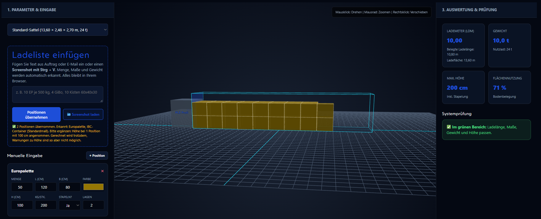
Especially handy on a busy dispatch day: with Paste load list you bring in freight details as text or as a screenshot with Ctrl + V, straight from your clipboard. Text recognition runs locally in your browser; your image is never uploaded to a server.
Postcode search across Europe
International transport needs reliable data across borders. The radius search currently covers 10 countries and we keep adding more, so you can find the right catchment area anywhere in Europe.